 Eclipse Surveyors Inc.Land Surveyors
Po Box 5058 STN Main, Fort Mcmurray, Alberta, T9H 3G2Eclipse Surveyors Inc.
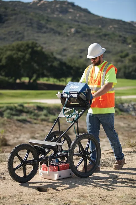
Eclipse Surveyors Inc. is a trusted name in the field of surveying, offering cutting-edge solutions for construction projects and land development. With advanced technologies like 3D laser scanning, UAV (drone) mapping, and precise line locating, they provide highly accurate data for engineers, architects, and project managers. Their expertise in construction layouts ensures flawless execution of building plans, making them a vital partner for residential, commercial, and industrial developments. Eclipse Surveyors Inc. is committed to precision, reliability, and innovation in every project they undertake.
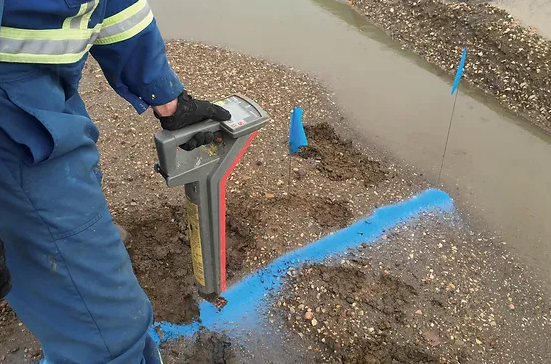
Line Locating – Accurate line locating services to identify underground utilities, ensuring safe and efficient excavation and construction while minimizing risks.
3D Laser Scanning – High-resolution 3D laser scanning technology for creating detailed digital models of structures and sites, ideal for design, inspection, and renovation projects.
UAV (Drone) Mapping – Advanced UAV mapping services that provide aerial surveys, topographic data, and real-time project insights, improving accuracy and saving time on large-scale projects.
Construction Layouts – Precise construction layout services for marking out building locations, foundations, and infrastructure, ensuring alignment with design specifications and project plans.
Surveyors – Professional surveying services for land, boundary, and topographic surveys, delivering detailed and accurate data for property development, construction, and legal purposes.
Eclipse Surveyors Inc. combines expertise, advanced technology, and a commitment to accuracy to deliver reliable surveying and mapping solutions. Whether it’s line locating, UAV mapping, or construction layouts, they ensure your projects are completed on time and within scope. Trust Eclipse Surveyors Inc. for all your surveying needs.
Products and Services
Location
Add Review
Your email address will not be published.
At Canadian Business Phone Book, we are passionate about helping businesses succeed in the digital landscape. With our comprehensive suite of digital marketing services, we strive to enhance your online presence, drive targeted traffic to your website, and ultimately boost your business growth.